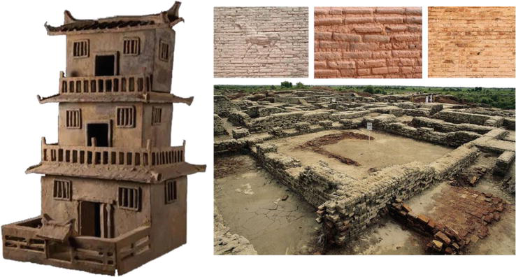
The history of estimations and takeoffs dates back to the time when humans first started building shelters. The remains of monumental cities and towers laid of bricks provide evidence of early estimation activities.
The first floor plans were simple – a pin was inserted into the ground, and a circle was scratched into the ground. Houses were then built over this circle using mud or bones. As time progressed, humans started using stones and later bricks to build their shelters upwards.
Invention of Bricks and standardization for estimation
Bricks, often considered the building blocks of civilization, helped establish the measurement system. They were the very first evidence of estimation activity. Builders would estimate the size of the brick by using a cast, calculate the number of bricks needed to build a wall and estimate labor and material to finally build a structure.
The creation of bricks introduced a standard unit of measurement in construction. Bricks were made using casts, which ensured that each brick was of the same size. This uniformity allowed for more precise estimations when planning structures.
Bricks help with Planning and Estimation
The use of bricks also necessitated planning and estimation. Before the construction could begin, builders had to estimate the amount of material needed (clay for the bricks) and the labor required for the task. This is arguably one of the earliest instances of project management in human history.
Standardization for estimation
The Indus Valley Civilization used bricks that followed a standard ratio of 4:2:1 (length to width to height), ensured by the use of standardized molds. This standardization is a clear indication of advanced planning and estimation.
Evolution of estimation in Mesopotamia – 17th Century
In the 17th century, in Mesopotamia, Ziggurats were built with bricks measuring 11.5 inches x 11.5 inches x 2.5 inches. This precision in construction couldn’t have come without some measurement units in writing. The Sumerians used a writing system known as cuneiform.
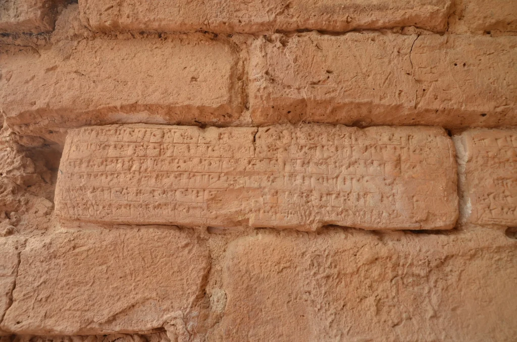
Ziggurats were made of millions of mud bricks, which required a standard unit of measurement for consistency. Each brick was made using a cast, ensuring uniformity in size. This standardization allowed builders to make precise estimations of the number of bricks required for each layer of the Ziggurat.
Advance planning for laying another layer
The construction of a Ziggurat began with a detailed plan. Builders had to estimate the amount of material needed (clay for the bricks) and the labor required for the task. They also had to calculate the number of bricks needed for each layer, considering that the size of the layers decreased as the structure rose.
Advanced Construction Techniques
The Ziggurats were built with a core of sun-dried bricks and an exterior covered with baked bricks for durability. This construction technique required careful planning and estimation to ensure the stability of the structure.
First known floor plan – 2100 BC
The first known floor plan, made in Sumeria during the Ur III period (circa 2100-2000 BC), provides a fascinating insight into the early practices of construction estimation. This clay tablet, bearing a detailed floor plan, is one of the few Sumerian building plans that have survived in such complete condition.
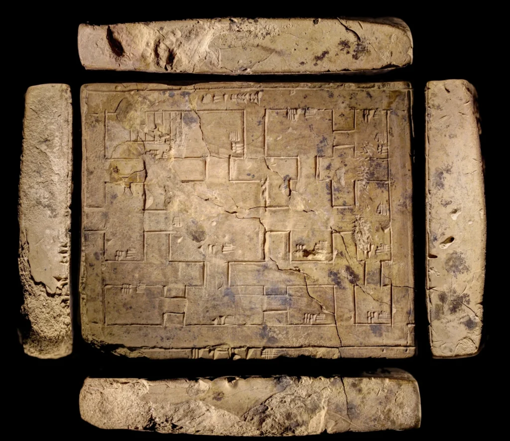
The tablet bears no inscription to identify the owner of the building or its function, but it was probably a building within a temple complex. It does not appear that such plans were reserved for special buildings, as most have fairly simple layouts. A plan such as this would have been useful for calculating the quantity of bricks needed to complete the construction. Clay or mud bricks were the most common building materials of the period and would have been molded and sun-baked for each construction.
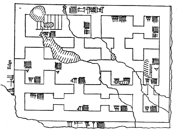
The plan was made out of clay, a common writing material, inscribed with a wedge-shaped tool (from which the word “cuneiform” is derived) and hardened in the sun. The plan is roughly to scale and gives nineteen measurements, which are given in terms of KÙŠ (a cubit of about 50 centimeters) and GAR (about 6 meters). The building itself would have been approximately 22 by 16 meters, a fairly substantial property.
The walls of the building were probably about 150 centimeters thick, which may have enabled the building to support a second story and provided insulation against extreme heat and cold. There is a doorway on the left wall, and the rectangles in the upper left-hand room probably indicate stairs. The layout is very regular and does not appear to be restricted by other buildings encroaching on the plot, which suggests the building was in the precinct of a temple or palace. The central room may have been a courtyard or acted as an ante-chamber within a shrine or small temple.
This discovery marks a significant milestone in the history of estimations and takeoffs. It shows that even 4000 years ago, humans could create detailed plans and make accurate estimations for large-scale construction projects.
Further evolution of estimation tools
Tape Measures
The first tape measure was invented in the early 1800s using the wire leftover from hoop skirts.

In 1868, a tape measure with spring action was patented.
In the 1940s the tape measure gained popularity in the construction industry.
More features were added over time like a belt clip and boxed housing, making it an indispensable tool in every workman’s toolbox.
The tape measure was a significant advancement in the field of estimation, providing a portable and convenient means to measure physical dimensions accurately.
Slide Rule
The slide rule, invented in the 17th century by William Oughtred, was a significant advancement in estimation tools.
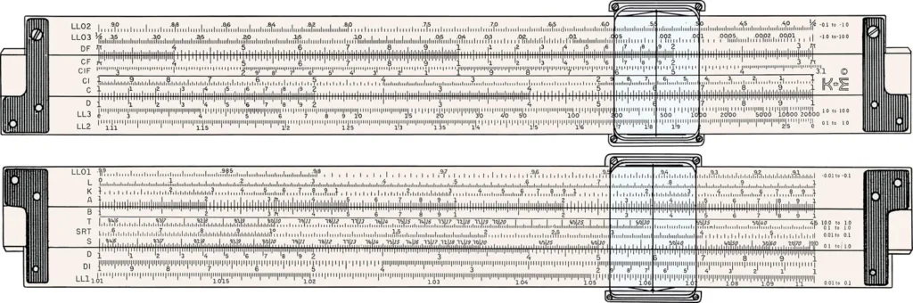
It used logarithms to perform multiplication and division by addition and subtraction. This tool was widely used until the mid-1970s when electronic calculators became more common.
Blueprints
Blueprints, which came into use in the 19th century, allowed for detailed plans to be made and shared.
This greatly improved the accuracy of estimations as builders could refer to these detailed plans when calculating the materials and labor required for a project.
The invention of blueprints marked a significant milestone in the history of construction and estimation, providing a standardized method for communicating complex architectural designs.
Calculators
The invention of calculators in the 20th century further revolutionized the process of estimation.
Calculators allowed for quick and accurate calculations, greatly improving the efficiency of the estimation process.
The first electronic calculator was introduced in the 1960s, and by the 1970s, pocket calculators had become widely available.
These devices significantly reduced the time required for complex calculations, making them an essential tool for estimators.
Excel
With the advent of computers, software like Excel became a common tool for estimations. Excel allows for complex calculations and data analysis, making it a powerful tool for estimators.
Introduced by Microsoft in 1985, Excel has evolved over the years, adding features such as pivot tables, advanced formulas, and data visualization tools that have made it an indispensable tool in many fields, including landscape construction estimation.
Digitizer Pens
Digitizer pens, also known as digital pens, capture the handwriting or brush strokes of a user and convert handwritten analog information into digital data.
This technology, which emerged in the late 20th century, allows for precise measurements and seamless integration into digital tools.
Digitizer pens have been used in various fields, including construction, where they have been used to digitize blueprints and other plans.
Digital Estimation Tools
Digital estimation tools represent the latest evolution in estimation technology. These tools, which became popular in the early 21st century, allow for highly productive and increasingly accurate property measurements and takeoffs directly from electronic plans.
They offer features such as access to historical bid data and integration with other software, providing a competitive advantage in the estimation process.
The introduction of e-takeoff tools marked a significant shift in the construction industry, moving away from manual takeoff methods towards more efficient and accurate digital solutions.